Measuring underground parking defects with smartphones and QR markers

In GPS-denied underground parking, AI maps defect locations precisely on the drawing

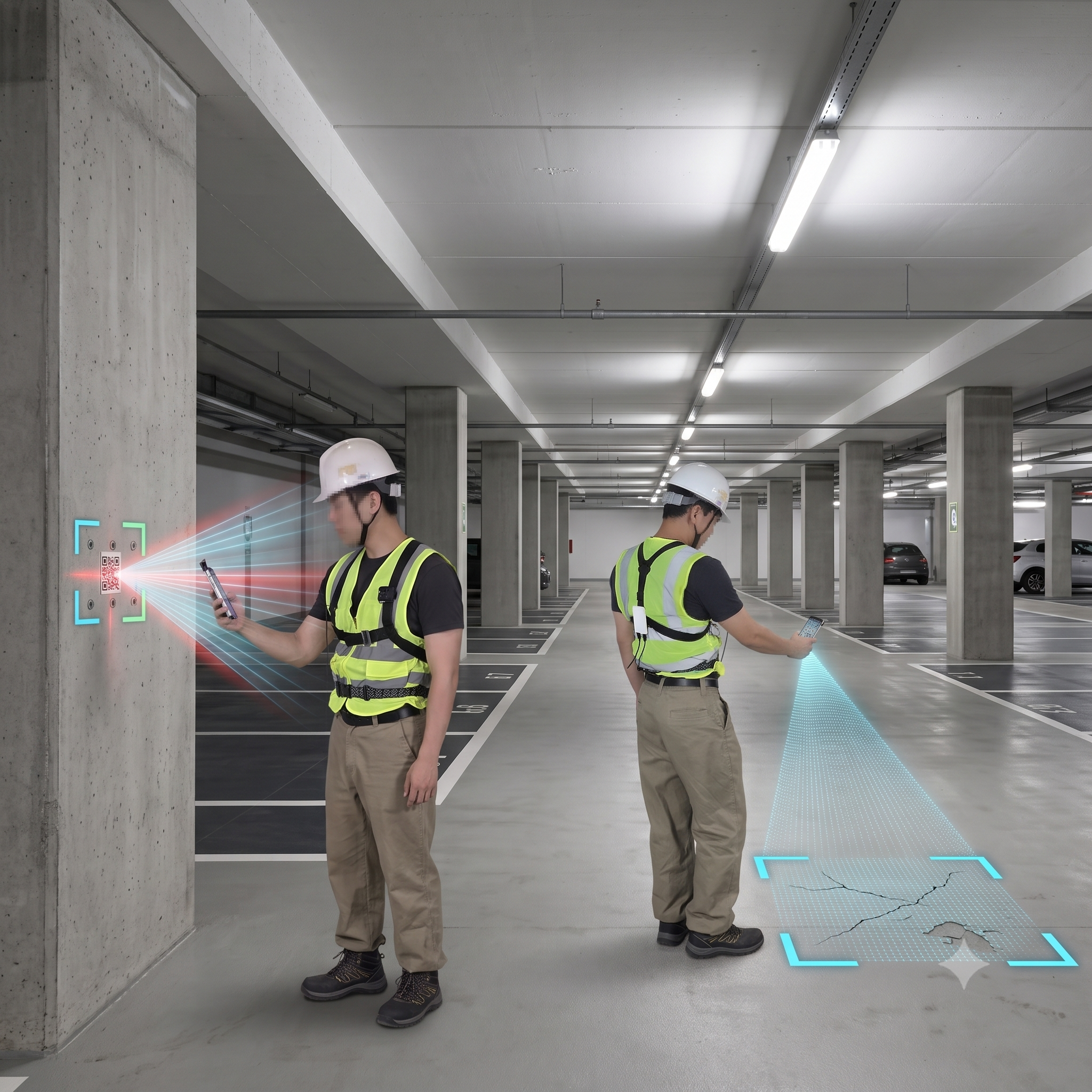
Zero fixed infrastructure (AP/beacon) installs. Smartphone capture alone auto-detects cracks and delamination in underground parking—from drawing mapping to quantity takeoff reports.

  • #InfraZero
  • #UndergroundParkingInspection
  • #AICrackDelamination
  • #AutoDrawingMapping
  • #QuantifiedReporting
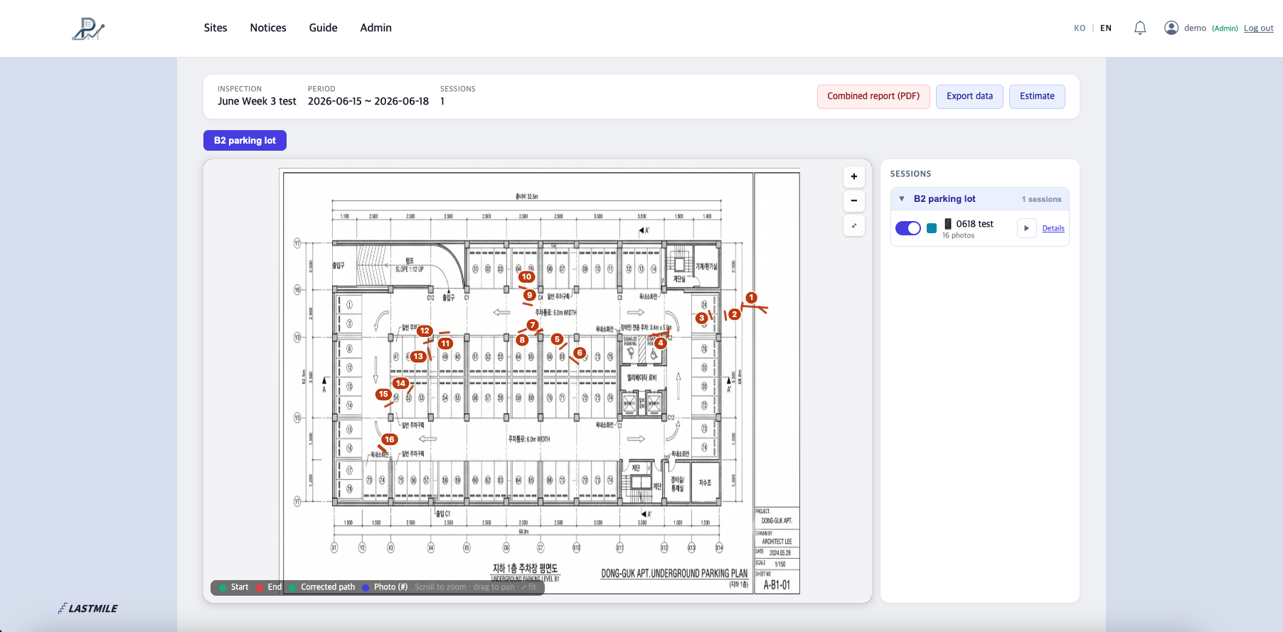
Underground parking defect monitoring dashboard

Admin Web

  • View underground parking status by building and floor
  • Defect summary monitoring dashboard

Facing these challenges?

Problems with legacy underground parking inspection
LASTMILE solution
Problem Tedious manual cross-checking of drawings and photos after capture
Solution Defect locations map automatically onto the parking floor plan as you capture
Problem Visual estimates make accurate repair area and quantity takeoffs difficult
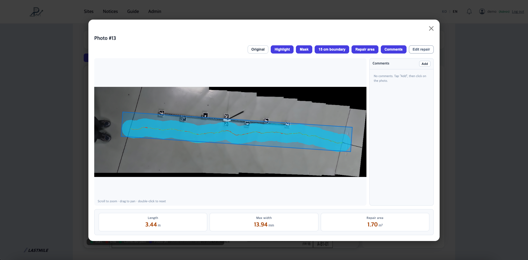
Solution AI quantifies defect length, maximum width, and repair area
Problem Report writing takes days to weeks after inspection
Solution Auto-generate submission summary reports within one week of upload

Key features

Zero fixed hardware

No AP, anchor, or beacon left on site. Start capture with two smartphones and two QR markers.

AI defect detection & quantification

AI automatically recognizes concrete cracks and delamination and calculates length, max width, and repair area.

Automatic drawing mapping

Even underground where GPS does not reach, smartphone positioning places defects on the drawing.

Automatic submission report generation

Output standard reports with repair area by zone and counts by defect type (crack, delamination, mixed).

Work process

01

On-site capture

Capture with two smartphones and QR markers.

02

Data upload

Complete same-day upload.

03

AI mapping & analysis

Automatically compute cracks and delamination.

04

Quantity takeoff & report

Receive submission reports within one week.

Primary use cases

New & rebuilt apartment complexes

Pre-handover inspections and defect repair quantity takeoffs.

Large malls & mixed-use complexes

Produce accurate statements of work for major repair projects.

Public facilities & large government offices

Build a database of underground structural safety inspection history.

Wondering how to manage indoor and underground spaces without GPS?

Digitalize field operations with LASTMILE's AI positioning—without costly infrastructure projects.

Talk to us / Request a quote